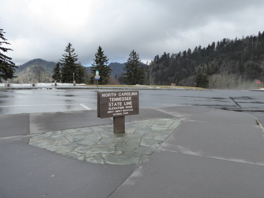
The photo was shot using a Panasonic DMC-ZS40 camera at an aperture of f/4, 1/640 sec. shutter speed and ISO 200. Flash did not fire, compulsory flash mode. The original image file has a resolution of 4896 x 3672 pixels, or in other words 18.0 megapixels.The photo has a resolution of 180 DPI.
According to the image metadata, the photo was shot on Tuesday 2nd of February 2016. The local time was 13:39:45. The timezone was America / Kentucky / Monticello, which is GMT -05:00. Please note that timezone was guessed using the GPS coordinates and may not be accurate. The EXIF timestamp may also be wrong if the date and time weren't set correctly in the digital camera.
Panasonic DMC-ZS40 camera has a built-in GPS receiver and allows geotagging on image files. The coordinates and location where the photo was taken is stored in the EXIF. According to GPS data analysis, the photo was taken at coordinates 35° 36' 39.60" N , 83° 25' 29.52" W. The elevation was 0 meters. Using reverse geocoding, the address associated with the coordinates is guessed as Appalachian Trail, Bryson City, TN 28713, USA. Depending on the GPS receiver and the reception conditions the accuracy may vary and the address should not be regarded as exact location.


