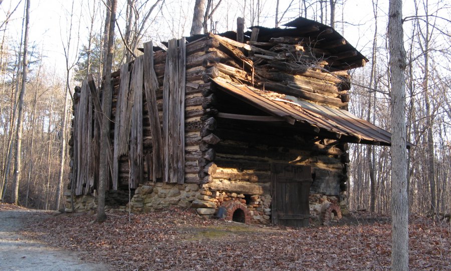
The photo was shot using a Canon PowerShot A710 IS camera at an aperture of f/3.2, 1/60 sec. shutter speed and ISO 75. Unknown 5-34mm lens was used to capture the image. Flash was fired in auto mode, red-eye reduction mode. The original image file has a resolution of 2694 x 1620 pixels, or in other words 4.4 megapixels.The photo has a resolution of 72 DPI.
According to the image metadata, the photo was shot on Sunday 10th of January 2010. The local time was 08:52:20. The timezone was America / Kentucky / Monticello, which is GMT -04:00. Please note that timezone was guessed using the GPS coordinates and may not be accurate. The EXIF timestamp may also be wrong if the date and time weren't set correctly in the digital camera.
Canon PowerShot A710 IS camera has a built-in GPS receiver and allows geotagging on image files. The coordinates and location where the photo was taken is stored in the EXIF. According to GPS data analysis, the photo was taken at coordinates 36° 20' 15.69" N , 80° 27' 31.50" W. The elevation was 314 meters. Using reverse geocoding, the address associated with the coordinates is guessed as Pilot Mountain Pkwy, Pinnacle, NC 27043, USA. Depending on the GPS receiver and the reception conditions the accuracy may vary and the address should not be regarded as exact location.


