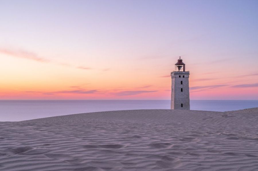
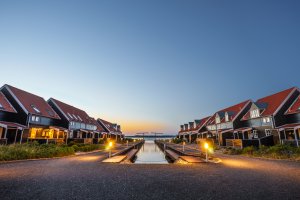
The photo was shot using a Canon EOS 5D Mark IV camera at an aperture of f/11, 300 sec. shutter speed and ISO 50. Flash did not fire, compulsory flash mode. The original image file has a resolution of 6720 x 4480 pixels, or in other words 30.1 megapixels.The photo has a resolution of 300 DPI.
According to the image metadata, the photo was shot on Saturday 7th of July 2018. The local time was 22:31:49. The timezone was Europe / Copenhagen, which is GMT +01:00. Please note that timezone was guessed using the GPS coordinates and may not be accurate. The EXIF timestamp may also be wrong if the date and time weren't set correctly in the digital camera.
Canon EOS 5D Mark IV camera has a built-in GPS receiver and allows geotagging on image files. The coordinates and location where the photo was taken is stored in the EXIF. According to GPS data analysis, the photo was taken at coordinates 57° 26' 51.67" N , 9° 46' 27.74" E. The elevation was 75 meters. Using reverse geocoding, the address associated with the coordinates is guessed as 244, Rubjergvej, Løkken, Hjørring Municipality, North Denmark Region, 9480, Denmark. Depending on the GPS receiver and the reception conditions the accuracy may vary and the address should not be regarded as exact location.