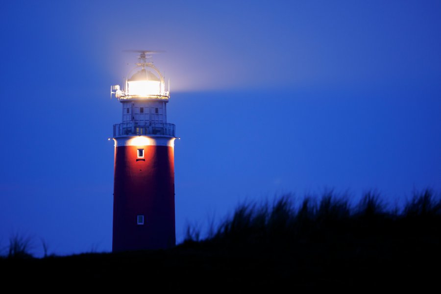
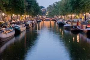
The photo was shot using a Canon EOS 50D camera at an aperture of f/4, 4 sec. shutter speed and ISO 100. Canon EF 70-200mm f/4L lens was used to capture the image. Flash did not fire, compulsory flash mode. The original image file has a resolution of 2339 x 1560 pixels, or in other words 3.6 megapixels.The photo has a resolution of 350 DPI.
According to the image metadata, the photo was shot on Tuesday 29th of April 2014. The local time was 21:40:53. The timezone was Europe / Amsterdam, which is GMT +02:00. Please note that timezone was guessed using the GPS coordinates and may not be accurate. The EXIF timestamp may also be wrong if the date and time weren't set correctly in the digital camera.
Canon EOS 50D camera has a built-in GPS receiver and allows geotagging on image files. The coordinates and location where the photo was taken is stored in the EXIF. According to GPS data analysis, the photo was taken at coordinates 53° 10' 20.76" N , 4° 51' 51.89" E. The elevation was 0 meters. Using reverse geocoding, the address associated with the coordinates is guessed as Stengweg, 1795 De Cocksdorp, Netherlands. Depending on the GPS receiver and the reception conditions the accuracy may vary and the address should not be regarded as exact location.