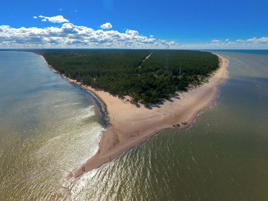
The photo was shot using a DJI FC330 camera at an aperture of f/2.8, 1/2857 sec. shutter speed and ISO 100. No flash function. The original image file has a resolution of 4000 x 3000 pixels, or in other words 12.0 megapixels.The photo has a resolution of 72 DPI.
According to the image metadata, the photo was shot on Friday 12th of August 2016. The local time was 15:20:56. The timezone was Europe / Riga, which is GMT +02:00. Please note that timezone was guessed using the GPS coordinates and may not be accurate. The EXIF timestamp may also be wrong if the date and time weren't set correctly in the digital camera.
DJI FC330 camera has a built-in GPS receiver and allows geotagging on image files. The coordinates and location where the photo was taken is stored in the EXIF. According to GPS data analysis, the photo was taken at coordinates 57° 45' 33.43" N , 22° 36' 25.27" E. The elevation was 13 meters. Using reverse geocoding, the address associated with the coordinates is guessed as Cape Kolka, Tukums — Ķesterciems — Mērsrags — Kolka, Kolka, Talsu novads, Courland, Latvia. Depending on the GPS receiver and the reception conditions the accuracy may vary and the address should not be regarded as exact location.