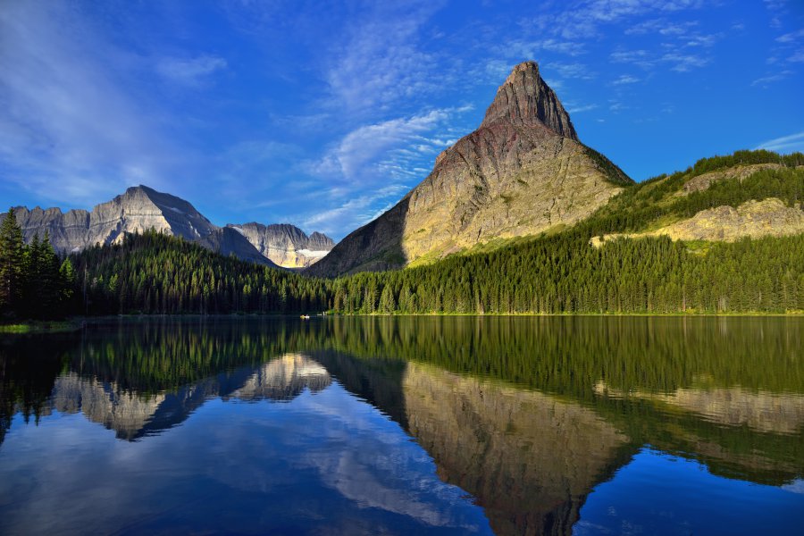
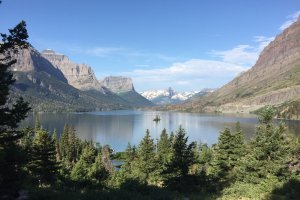
The photo was shot using a NIKON D800E camera at an aperture of f/5.6, 1/125 sec. shutter speed and ISO 100. AF-S Nikkor 24-120mm f/4G ED VR lens was used to capture the image. Flash did not fire, compulsory flash mode. The original image file has a resolution of 7360 x 4912 pixels, or in other words 36.2 megapixels.The photo has a resolution of 300 DPI.
According to the image metadata, the photo was shot on Friday 13th of September 2013. The local time was 08:10:21. The timezone was America / Creston, which is GMT -07:00. Please note that timezone was guessed using the GPS coordinates and may not be accurate. The EXIF timestamp may also be wrong if the date and time weren't set correctly in the digital camera.
NIKON D800E camera has a built-in GPS receiver and allows geotagging on image files. The coordinates and location where the photo was taken is stored in the EXIF. According to GPS data analysis, the photo was taken at coordinates 48° 47' 29.08" N , 113° 39' 41.04" W. The elevation was 1494 meters. Using reverse geocoding, the address associated with the coordinates is guessed as Glacier National Park, Loop Trail, Browning, MT 59417, USA. Depending on the GPS receiver and the reception conditions the accuracy may vary and the address should not be regarded as exact location.