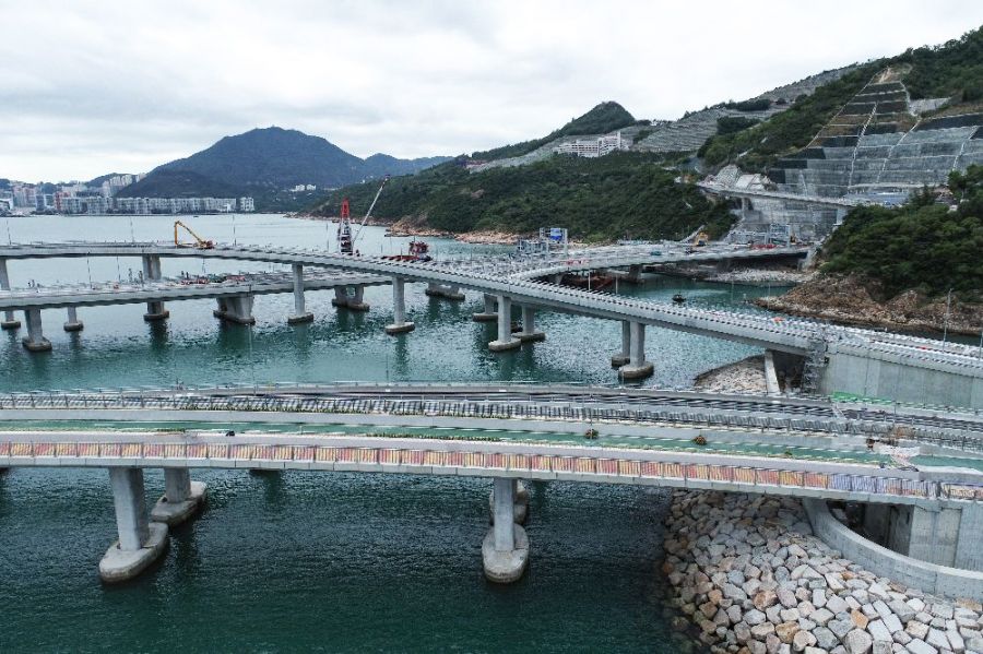
The photo was shot using a DJI FC6310R camera at an aperture of f/3.2, 1/2000 sec. shutter speed and ISO 100. No flash function. The original image file has a resolution of 0 x 0 pixels, or in other words 0.0 megapixels.The photo has a resolution of 72 DPI.
According to the image metadata, the photo was shot on Monday 5th of December 2022. The local time was 12:40:44. The timezone was Asia / Hong_Kong, which is GMT +08:00. Please note that timezone was guessed using the GPS coordinates and may not be accurate. The EXIF timestamp may also be wrong if the date and time weren't set correctly in the digital camera.
DJI FC6310R camera has a built-in GPS receiver and allows geotagging on image files. The coordinates and location where the photo was taken is stored in the EXIF. According to GPS data analysis, the photo was taken at coordinates 22° 17' 50.09" N , 114° 15' 24.05" E. Using reverse geocoding, the address associated with the coordinates is guessed as Tseung Lam Highway, Tseung Kwan O South, Tiu Keng Leng, Tseung Kwan O, Sai Kung District, New Territories, Hong Kong, China. Depending on the GPS receiver and the reception conditions the accuracy may vary and the address should not be regarded as exact location.

