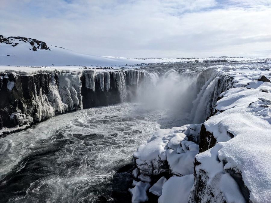
The photo was shot using a Google Pixel 4a camera at an aperture of f/1.7, 1/23256 sec. shutter speed and ISO 120. Pixel 4a back camera 4.38mm f/1.73 lens was used to capture the image. Flash did not fire, compulsory flash mode. The original image file has a resolution of 4032 x 3024 pixels, or in other words 12.2 megapixels.The photo has a resolution of 72 DPI.
According to the image metadata, the photo was shot on Saturday 9th of April 2022. The local time was 13:10:06. The timezone was Atlantic / Reykjavik, which is GMT +00:00. Please note that timezone was guessed using the GPS coordinates and may not be accurate. The EXIF timestamp may also be wrong if the date and time weren't set correctly in the digital camera.
Google Pixel 4a camera has a built-in GPS receiver and allows geotagging on image files. The coordinates and location where the photo was taken is stored in the EXIF. According to GPS data analysis, the photo was taken at coordinates 65° 48' 18.91" N , 16° 23' 14.20" W. The elevation was 398 meters. The camera was pointing Northeast at 61.00 degrees. Using reverse geocoding, the address associated with the coordinates is guessed as Selfoss, Dettifossvegur vestri, Norðurþing, Northeastern Region, Iceland. Depending on the GPS receiver and the reception conditions the accuracy may vary and the address should not be regarded as exact location.