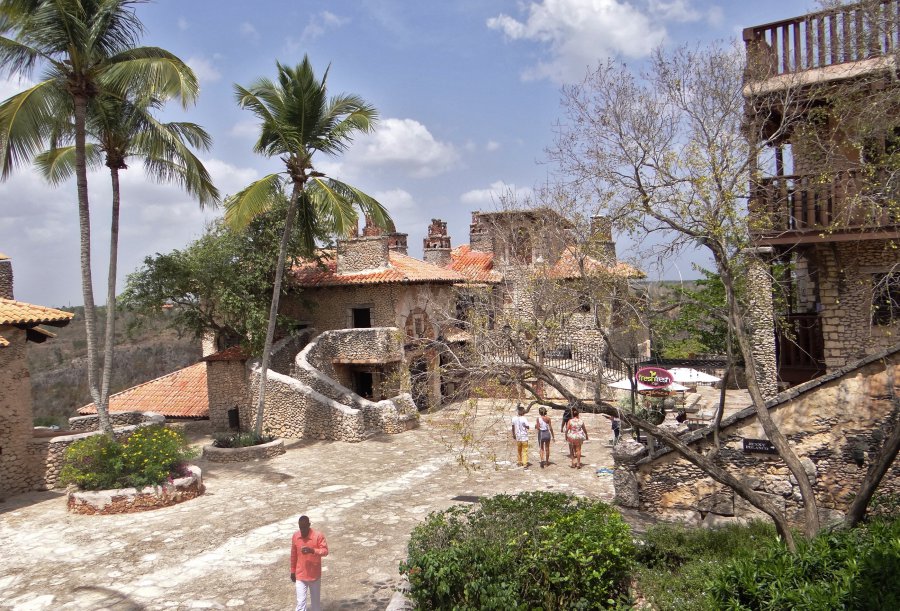
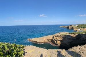
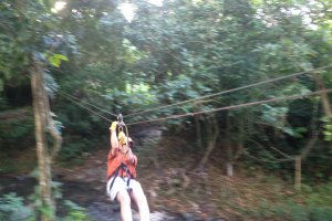
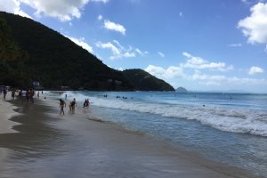
The photo was shot using a SONY DSC-HX200V camera at an aperture of f/2.8, 1/1250 sec. shutter speed and ISO 100. 4.8-144mm f/2.8-5.6 lens was used to capture the image. Flash did not fire, compulsory flash mode. The original image file has a resolution of 2800 x 1902 pixels, or in other words 5.3 megapixels.The photo has a resolution of 350 DPI.
According to the image metadata, the photo was shot on Saturday 23rd of May 2015. The local time was 14:06:35. The timezone was America / Santo_Domingo, which is GMT -04:00. Please note that timezone was guessed using the GPS coordinates and may not be accurate. The EXIF timestamp may also be wrong if the date and time weren't set correctly in the digital camera.
SONY DSC-HX200V camera has a built-in GPS receiver and allows geotagging on image files. The coordinates and location where the photo was taken is stored in the EXIF. According to GPS data analysis, the photo was taken at coordinates 18° 25' 17.76" N , 68° 53' 22.48" W. The elevation was 80 meters. The camera was pointing East at 87.75 degrees. Using reverse geocoding, the address associated with the coordinates is guessed as Casitas Campestre's Road, La Romana 22000, Dominican Republic. Depending on the GPS receiver and the reception conditions the accuracy may vary and the address should not be regarded as exact location.
Rue F. Eboué, Marigot, Collectivité de Saint-Martin, Collectivity of Saint Martin
613.28 km / 380.84 miles away
Buchanan Road, Conaree Village, Saint Peter Basseterre Parish, Saint Kitts and Nevis
664.72 km / 412.79 miles away

North Peligan Drive, Basseterre, Saint George Basseterre Parish, Saint Kitts and Nevis
665.08 km / 413.01 miles away


