The photo was shot using a Panasonic DMC-GF1 camera at an aperture of f/6.3, 1/500 sec. shutter speed and ISO 100. Flash did not fire, compulsory flash mode. The original image file has a resolution of 4000 x 3000 pixels, or in other words 12.0 megapixels.The photo has a resolution of 72 DPI.
According to the image metadata, the photo was shot on Saturday 1st of February 2014. The local time was 16:10:14. The timezone was America / Denver, which is GMT -06:00. Please note that timezone was guessed using the GPS coordinates and may not be accurate. The EXIF timestamp may also be wrong if the date and time weren't set correctly in the digital camera.
Panasonic DMC-GF1 camera has a built-in GPS receiver and allows geotagging on image files. The coordinates and location where the photo was taken is stored in the EXIF. According to GPS data analysis, the photo was taken at coordinates 37° 56' 8.51" N , 107° 50' 49.56" W. The elevation was 0 meters. Using reverse geocoding, the address associated with the coordinates is guessed as Uncompahgre National Forest, 119 Lost Creek Lane, Mountain Village, CO 81435, USA. Depending on the GPS receiver and the reception conditions the accuracy may vary and the address should not be regarded as exact location.
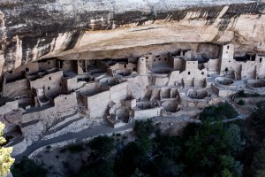
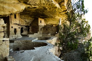
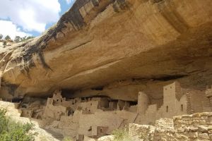
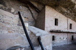
Cliff Palace Overlook, Mesa Verde National Park, Colorado, United States
101.64 km / 63.12 miles away

