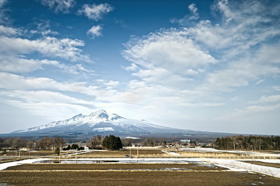
The photo was shot using a NIKON D4S camera at an aperture of f/2.8, 1/250 sec. shutter speed and ISO 110. AF-S Zoom-Nikkor 24-70mm f/2.8G ED lens was used to capture the image. Flash did not fire.. The original image file has a resolution of 4538 x 3020 pixels, or in other words 13.7 megapixels.The photo has a resolution of 300 DPI.
According to the image metadata, the photo was shot on Saturday 28th of March 2015. The local time was 16:50:33. The timezone was Asia / Sakhalin, which is GMT +10:00. Please note that timezone was guessed using the GPS coordinates and may not be accurate. The EXIF timestamp may also be wrong if the date and time weren't set correctly in the digital camera.
NIKON D4S camera has a built-in GPS receiver and allows geotagging on image files. The coordinates and location where the photo was taken is stored in the EXIF. According to GPS data analysis, the photo was taken at coordinates 42° 2' 7.91" N , 140° 36' 16.72" E. The elevation was 236 meters. Using reverse geocoding, the address associated with the coordinates is guessed as Hokkaido Expressway, Komagatake, Mori-machi, Kayabe-gun, Hokkaidō 049-2141, Japan. Depending on the GPS receiver and the reception conditions the accuracy may vary and the address should not be regarded as exact location.
