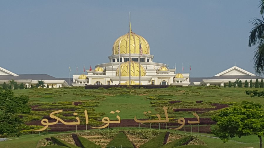
The photo was shot using a Samsung SM-G920I camera at an aperture of f/1.9, 1/2200 sec. shutter speed and ISO 40. Flash did not fire.. The original image file has a resolution of 2048 x 1152 pixels, or in other words 2.4 megapixels.The photo has a resolution of 72 DPI.
According to the image metadata, the photo was shot on Wednesday 23rd of March 2016. The local time was 09:43:38. The timezone was Asia / Kuala_Lumpur, which is GMT +08:00. Please note that timezone was guessed using the GPS coordinates and may not be accurate. The EXIF timestamp may also be wrong if the date and time weren't set correctly in the digital camera.
Samsung SM-G920I camera has a built-in GPS receiver and allows geotagging on image files. The coordinates and location where the photo was taken is stored in the EXIF. According to GPS data analysis, the photo was taken at coordinates 3° 9' 36.00" N , 101° 40' 3.00" E. The elevation was 88 meters. Using reverse geocoding, the address associated with the coordinates is guessed as Jalan Tuanku Abdul Halim, 50480 Kuala Lumpur, Wilayah Persekutuan Kuala Lumpur, Malaysia. Depending on the GPS receiver and the reception conditions the accuracy may vary and the address should not be regarded as exact location.
Jalan Sultan Hishamuddin, Kuala Lumpur, Wilayah Persekutuan Kuala Lumpur, Malaysia
3.27 km / 2.03 miles away
